The beach in San Diego is not one continuous type of place. An aerial view helps explain the difference between an oceanfront strand, a sheltered bay, a cliff-backed shore and a small cove. Use that perspective to choose a neighborhood and an access point, then return to ground-level information for parking, lifeguards and today's conditions.
Ocean shoreline versus Mission Bay
From above, the long, narrow Mission Beach area makes the distinction especially clear: Pacific surf lies on one side, while Mission Bay's waterways and coves lie on the other. A property or activity described as waterfront may face either setting. Check a map before assuming that a bayfront reservation means stepping directly onto an ocean surf beach.
The difference matters for activities as well as photographs. A bay cruise is not automatically an ocean excursion, and an oceanfront walk does not tell you what launching a kayak in the bay will involve. Choose the environment first, then compare specific operators and public access. Our Mission Bay cruises guide covers the booking distinctions.
Mission Beach and Pacific Beach
The city describes Mission Beach as part of the Golden Strand, between South Mission Beach and Pacific Beach. Pacific Beach extends south from near Crystal Pier before becoming Mission Beach. These are busy urban beach areas, with permanent lifeguard stations and amenities listed by the city.
From an elevated perspective, their broad sand and connected development can appear simpler than a cliff-backed coast. At street level, however, parking, crowds and the distance to the particular access you want still matter. Identify your meeting point precisely. A generic pin for Pacific Beach may leave you farther from your chosen swimming area or group than expected.
La Jolla's coves, caves and cliffs
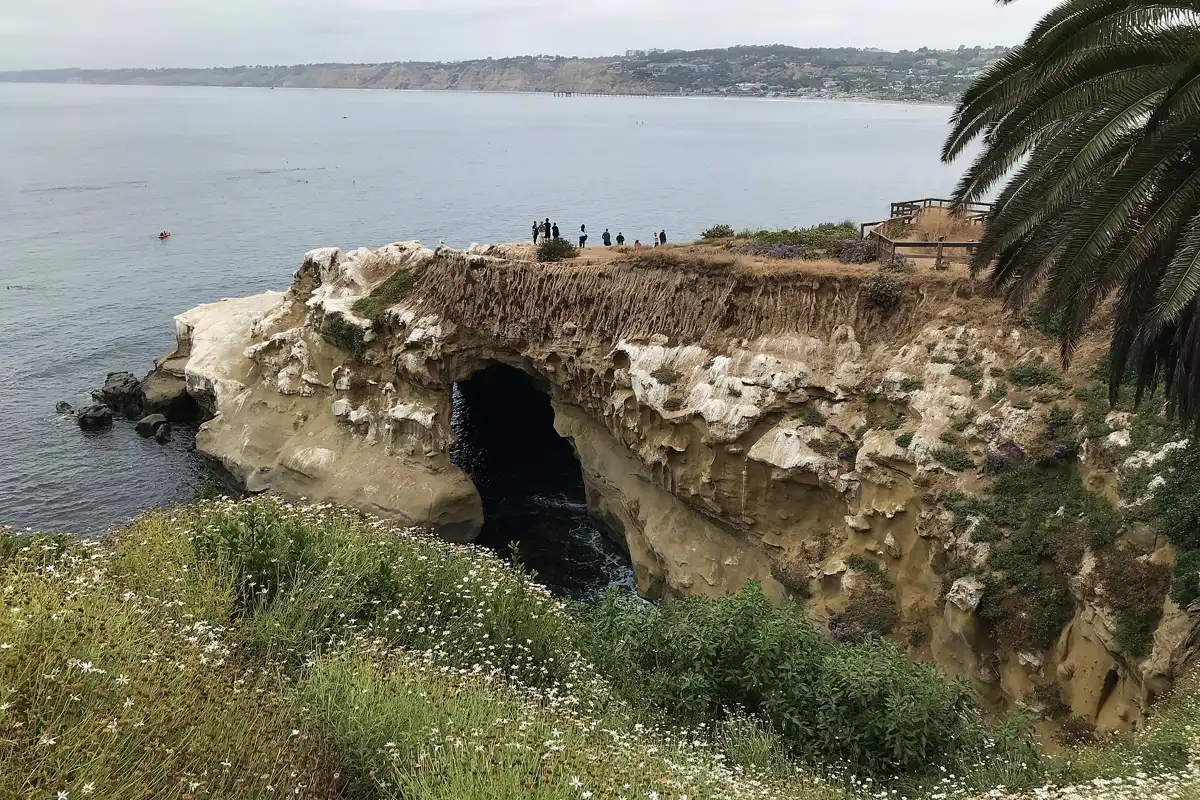
La Jolla's shoreline changes character over short distances. A small cove, a broad sandy beach and a cliff with sea caves are different destinations, even when one photograph includes all three. Do not use their visual proximity as a substitute for a public walking route.
The La Jolla sea caves guide explains land access versus ocean activities. Farther north, Black's Beach lies below tall cliffs. Its appearance from the gliderport area can be spectacular, but the city warns that access is difficult and the slopes are unstable. A view from above is useful precisely because it reveals why reaching the sand may not be straightforward.
What an aerial image cannot tell you
A photograph cannot verify the safety of a trail, whether a beach is open or how much sand remains at high tide today. Perspective can hide steepness and make distances look small. Pale water does not guarantee a shallow, current-free swimming area, and a dark patch may have several possible explanations.
Use aerial images as orientation, not as navigation instructions. Consult current official maps, signs and access information before choosing an approach. If an image shows a shortcut, a closed road or people near an edge, do not assume that reproducing the scene is permitted. A route visible from the air may cross restricted land.
Lifeguards and ocean decisions
San Diego Lifeguards lists permanent stations at several city beaches and seasonal coverage in additional locations. A tower in a photograph is not proof that it is staffed at the time you arrive. Ask about the current swimming and surfing zones and follow the flags and lifeguard directions.
Rip currents can occur on beaches that look gentle from above. The city's safety guidance emphasizes swimming near lifeguards and not swimming alone. Choose a water activity according to conditions and ability rather than the beach's visual appeal. It is entirely reasonable to enjoy a walk and stay out of the water.
Planning a coastal flight or scenic viewpoint visit
This guide does not claim to document a flight taken by our editors or recommend an unverified aircraft operator. If you want a sightseeing flight, confirm the actual route, weather policy, passenger requirements and operator credentials directly before booking. A route advertised with a coast photo may not include every landmark shown.
For a land-based alternative, use lawful public viewpoints and stay behind barriers. Do not lean over cliffs for an imitation aerial photograph. If using a drone, check the applicable aviation, land-management and wildlife rules first; a beach's popularity does not establish permission to launch or fly there.
Turn the overview into a workable beach day
Choose one main area, identify a legal access point and check current parking and beach rules. Bring layers, sun protection and water. If swimming is the goal, put lifeguard coverage and conditions ahead of a dramatic backdrop. If photography is the goal, choose a safe position with a straightforward exit.
Our San Diego beach guide helps compare destinations, while the individual pages handle their specific access issues. An aerial perspective is the beginning of good planning: it shows the structure of the coast. The final decision belongs to the conditions and rules you find on the ground.
By 70 Miles of Coast editors.
Sources & further reading
Official information and references for this guide. Check the source for current access, rules and conditions.