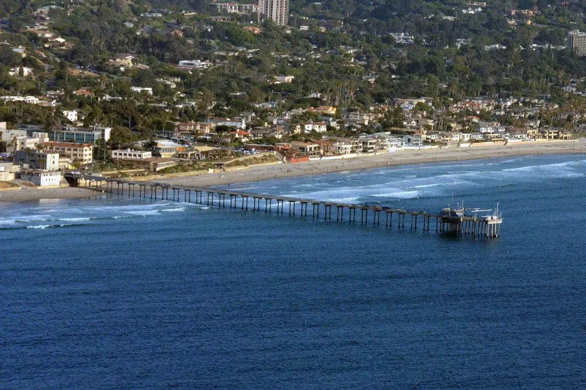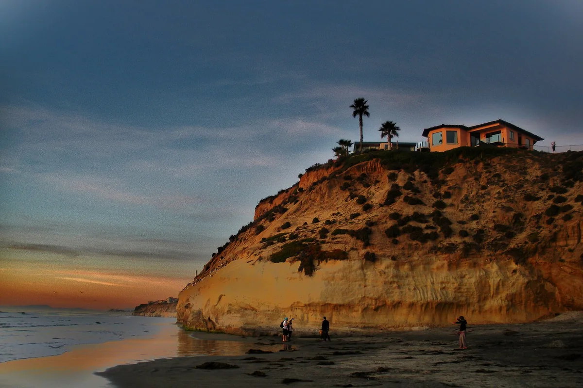
Torrey Pines Beach is the broad shoreline below the sandstone bluffs between La Jolla and Del Mar. Torrey Pines State Beach combines an easy-to-reach stretch of sand near the lagoon entrance with a more tide-sensitive coast farther south. For a successful visit, decide whether you want a simple beach day or a reserve hike, check the tide and surf, and leave generous space between your group and the cliffs.
Torrey Pines State Beach in San Diego: know the layout
California State Parks describes the beach as extending from Del Mar past Los Peñasquitos Lagoon to the sandstone cliffs below Torrey Pines Mesa. The natural reserve sits above the water, while the state beach is the shoreline below it. Those names refer to connected but different experiences. You can spend a morning on the sand without hiking into the upper reserve, or walk the reserve’s trails without descending to the beach.
The lagoon opening and North Torrey Pines Road are useful landmarks when reading a map. North and south beach parking areas serve different starting points; confirm the entrance you intend to use before driving. A generic search for “Torrey Pines Beach CA” can put you at a beach entrance, a reserve entrance or a viewpoint. Build the plan around an official entrance rather than whichever map pin appears first.
North beach or Torrey Pines south beach?
Choose the shoreline near your parking entrance when the goal is a short walk, time on the sand or a picnic. The state beach page lists a picnic area and parking near the North Torrey Pines Road entrance. If you are carrying chairs or traveling with someone who does not want a steep climb, this is a different proposition from arriving through the reserve’s Beach Trail.
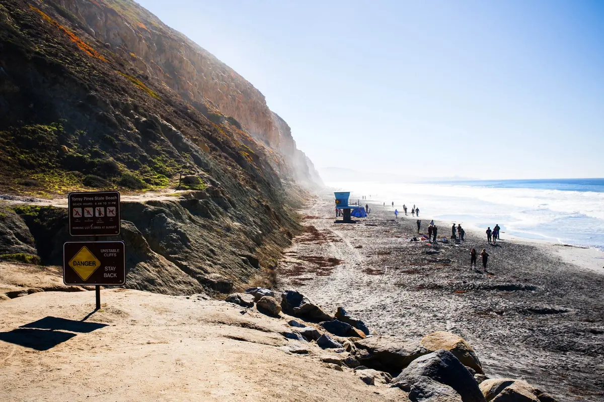
Torrey Pines south beach brings the cliffs and Flat Rock into the plan. It also makes the width of exposed sand more important. At a high tide, the same walk that looked spacious earlier can leave little room between the water and the bluff. Do not choose a route that depends on squeezing past a headland or standing beneath an overhang. A shorter out-and-back is better than committing to a crossing without a comfortable exit.
Parking, admission and when to arrive
Use the California State Parks beach page for current parking and admission information. Different lots and entrances can have different operating arrangements. Check the official site for current fees rather than relying on an old parking price or assuming that a pass covers every circumstance.
Before unloading, read the lot signs and identify the return route. Photographing an entrance sign or saving your car location can help when you return from a longer shoreline walk. Carry water and sun protection even if the sky is gray. The beach and the upper trails are exposed, and a foggy start is not a guarantee of cool weather for the whole visit. Keep valuables out of sight and leave enough time to return before the posted gate closure.
Torrey Pines cliffs: the essential safety rule
The red and tan bluffs are a major reason people come here, but they are not safe shelter. State Parks warns that cliff collapses and rockslides can occur without notice. Its guidance is to favor low tide, when more sand may be available, and maintain at least 10 feet from the bluffs. Treat that as a minimum buffer, not a promise that any particular location is safe.
Do not sit against the cliff, let children dig at its base or climb loose slopes to reach a viewpoint. Stay on marked trails above and use designated beach access below. If the tide or surf leaves no room to keep away from the bluff, turn back. Recent rain, loose rock or a closure sign is a reason to change plans, not to find an unofficial path around the problem.
Flat Rock at Torrey Pines
Flat Rock is a landmark near the meeting of the reserve’s beach-access routes and the shoreline. State Parks’ trail information says Broken Hill Trail joins Beach Trail above Flat Rock. That makes it a useful orientation point for hikers, but not a requirement for a worthwhile beach visit. You do not need to reach Flat Rock to enjoy the more accessible sand near the entrance.
Time a walk toward it with the tide, swell and your return journey in mind. A tide prediction describes water level, not the reach of every wave. Keep your exit visible and do not round a rocky section if the return would require wading or scrambling. Do not assume an exposed rock platform will remain exposed while you take photographs.
Torrey Pines tide pools and low-tide exploring
Searches for Torrey Pines tide pools often lead visitors toward rocky shoreline around Flat Rock. Think of this as condition-dependent shore observation rather than a guaranteed tide-pool outing. Sand cover, water level and wave energy affect what is visible. Low tide may improve access, but strong surf can still make a rocky edge unsafe.
Look without collecting, prying or rearranging animals. Watch for wet, slippery surfaces and keep children within reach. If observing small intertidal animals is the main goal, compare the broader San Diego tide-pool guide before choosing a location. Do not trade a safe exit for one more pool. Return while you still have a wide, obvious route, not when incoming water forces the decision.
Hiking down from Torrey Pines State Natural Reserve
The official reserve information describes Beach Trail as a roughly three-quarter-mile route descending about 300 feet, with stairs at the final beach access. That downhill distance also has to be climbed on the return unless you have deliberately planned a different lawful route. Shoes suitable for uneven trail surfaces are more useful here than beach sandals.
Rain can close reserve trails to protect fragile soils. Check official park and trail information before setting out. Do not infer that an open parking lot means every trail is open. For an above-the-beach visit, use the Torrey Pines reserve guide to distinguish overlook walks from beach-access hikes.
Torrey Pines surf and Black’s Beach are not the same plan
Swimming and surfing are established uses of the state beach, but the name alone tells you nothing about the day’s currents, shorebreak or suitable entry point. Ask lifeguards where swimming and surfing belong and whether conditions fit your ability. Stay out if the ocean looks beyond your comfort level; a shoreline walk is a complete visit.
“Torrey Pines Black Beach” and “Black Beach Torrey Pines” are searches for a neighboring stretch of coast, not another name for every part of this state beach. The Gliderport trail is a separate access choice and is not the reserve’s Beach Trail. Do not improvise a cliff descent or assume you can connect all these places along the sand at any tide.
Dogs, beach-day planning and a simple itinerary
State Parks prohibits dogs within the reserve and beach boundaries, including inside vehicles. Plan a different outing if a dog is part of your group. Do not leave one in a parked car while the rest of the party walks the beach. Follow all posted restrictions and bring a bag for everything you carried in.
For a first visit, keep the itinerary simple: check official alerts, park at the intended beach entrance, walk a manageable distance while watching the water, then return by the same safe route. Add an upper-reserve walk only if your group has the time, energy and proper footwear. The best Torrey Pines beach day is not the longest route; it is the one that fits the tide, conditions and people with you.
Questions before you go
Is Torrey Pines Beach the same as the reserve?
No. The state beach is the shoreline; the natural reserve protects the bluff-top landscape and has trails that can connect to the beach.
Can you walk to Flat Rock at any tide?
Do not assume so. Tide and surf can remove the safe passage between the water and cliffs. Turn back rather than wade or scramble around a blocked section.
Sources & further reading
Official information and references for this guide. Check the source for current access, rules and conditions.